
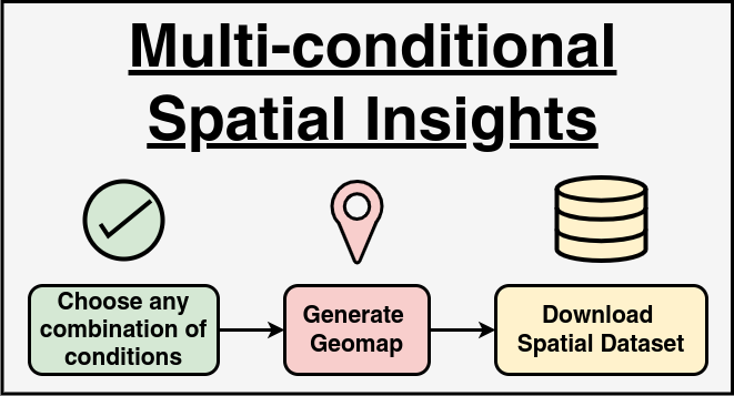
This module is designed to provide an efficient way to filter and visualize spatial data related to query calls received at the Kisan Call Center. It allows users to refine datasets based on various conditions such as year, state, crop, and query type. By selecting any combination of filters, users can generate a refined dataset, which is then mapped using an interactive geo-visualization. The module benefits agricultural researchers, policymakers, and farmers by providing a clear spatial representation of agricultural concerns. Researchers can analyze patterns of disease prevalence, government officials can allocate resources more effectively, and agricultural extension workers can use the data to identify areas that need immediate intervention. The ability to download the filtered data as a CSV file also allows users to perform further offline analysis.
Home  Clear Analysis
Developed by ICAR-IASRI, New Delhi, India